What to do
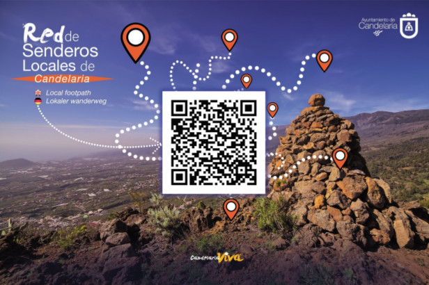
Candelaria has a network of local footpaths approved by Tenerife’s Island Council and signposted according to international standards. To walk on approved trails means to trek on selected trails that preferably run through natural environments, which have been previously analysed, studied, conditioned, and signposted to offer safety, quality, and enjoyment along their route through spectacular municipal landscapes.
The layout of trails is a key factor. Along with them you can discover their inherent history, surrounding ecosystems, landscapes, ethnographic and heritage elements to be found along each route.
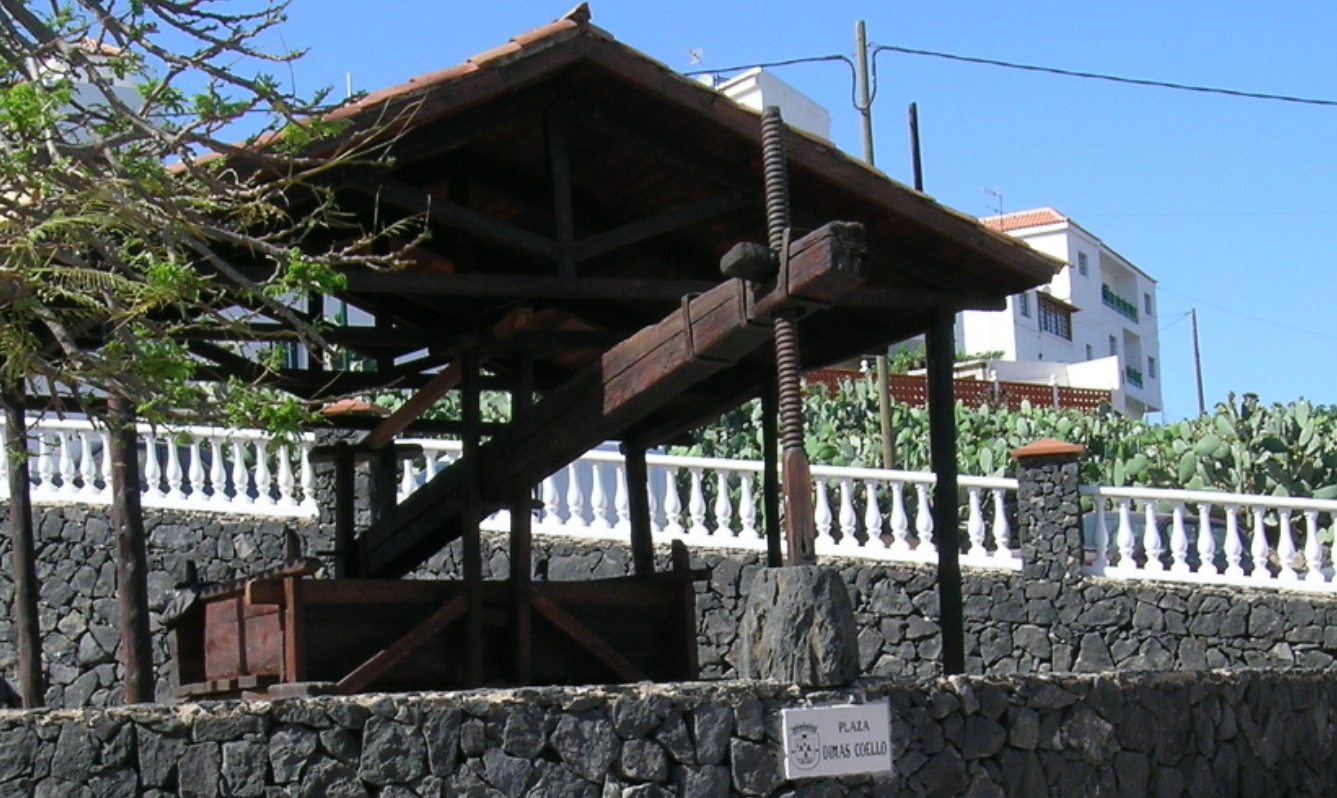
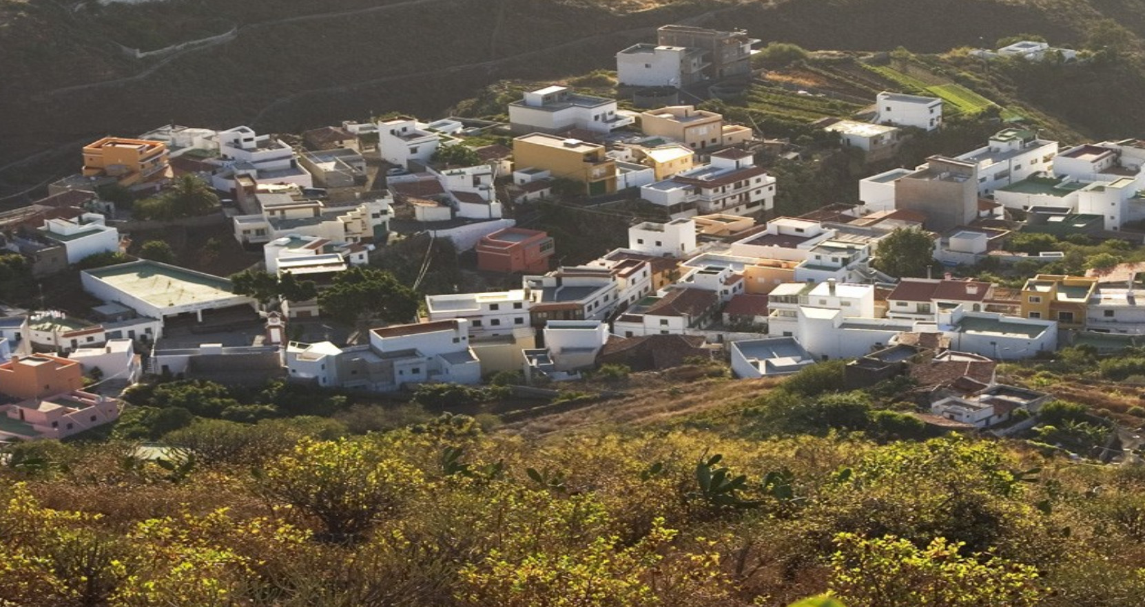
Candelaria has over twenty paths and trails. They belong to the local ethnographic heritage that is closely linked to a past and predominant traditional way of living until a few decades ago. It was mainly based on the agricultural sector.
For the peasantry, the orography was a key conditioning factor to overcome and obtain fertile land where agricultural work could be feasible. As a result, a wide network of local roads linked the municipality from the upper part to the coast and to the rest of the island.
To a better understanding of this network, we classify it as follows:
Pilgrimage routes: A very important legacy from prehispanic times related to the religious cult of the Virgin of Candelaria. Pilgrims from all parts of the island annually come to Candelaria. They use these routes and arrive on the eve of her festivity. These routes were originally used by Guanches for the annual celebration of the Beñesmén.
Cattle tracks.: They started to be built in the 16th century for a faster and more comfortable transit of people and pack animals that transported goods around the island. They were essential for land communications.
Carriage roads:They allowed the passage of wagons or carts to link the most important towns and agricultural areas. Like the cattle tracks, they were constructed with stone paving to avoid the deterioration caused by these means of transport.
Bridle paths: They were wide enough for animals to pass. Unlike the carriage roads, they connected secondary population centres with many agricultural areas mainly located in the midlands. In this case, those sections difficult to walk on as a result of slopes or water erosion were paved.
Paths or footpaths: These paths were only used by people who regularly walked between production and residential areas.
The lack of use and the subsequent plant colonization has resulted in many of these traditional bridle paths, carriage roads, or footpaths disappearing. However, the Department of Environment of Candelaria is working to recover and signpost a large part of traditional paths with the aim of integrating them in the Local Paths’ Network whilst preserving and promoting them as a tourist resource for visitors, thus increasing also the cultural and leisure offer for the local community.
In 2007, Tenerife Island Council and the Mountaineering Federation of the Canary Islands approved the harmonization of the Local Paths’ Network of Candelaria by adding seven paths that meet the optimum safety conditions, cleanliness, and signposting to enjoy trekking in nature.
We invite you to discover a very present past. With your contribution, it will have a better future.
For further inforheremation on trails, here.
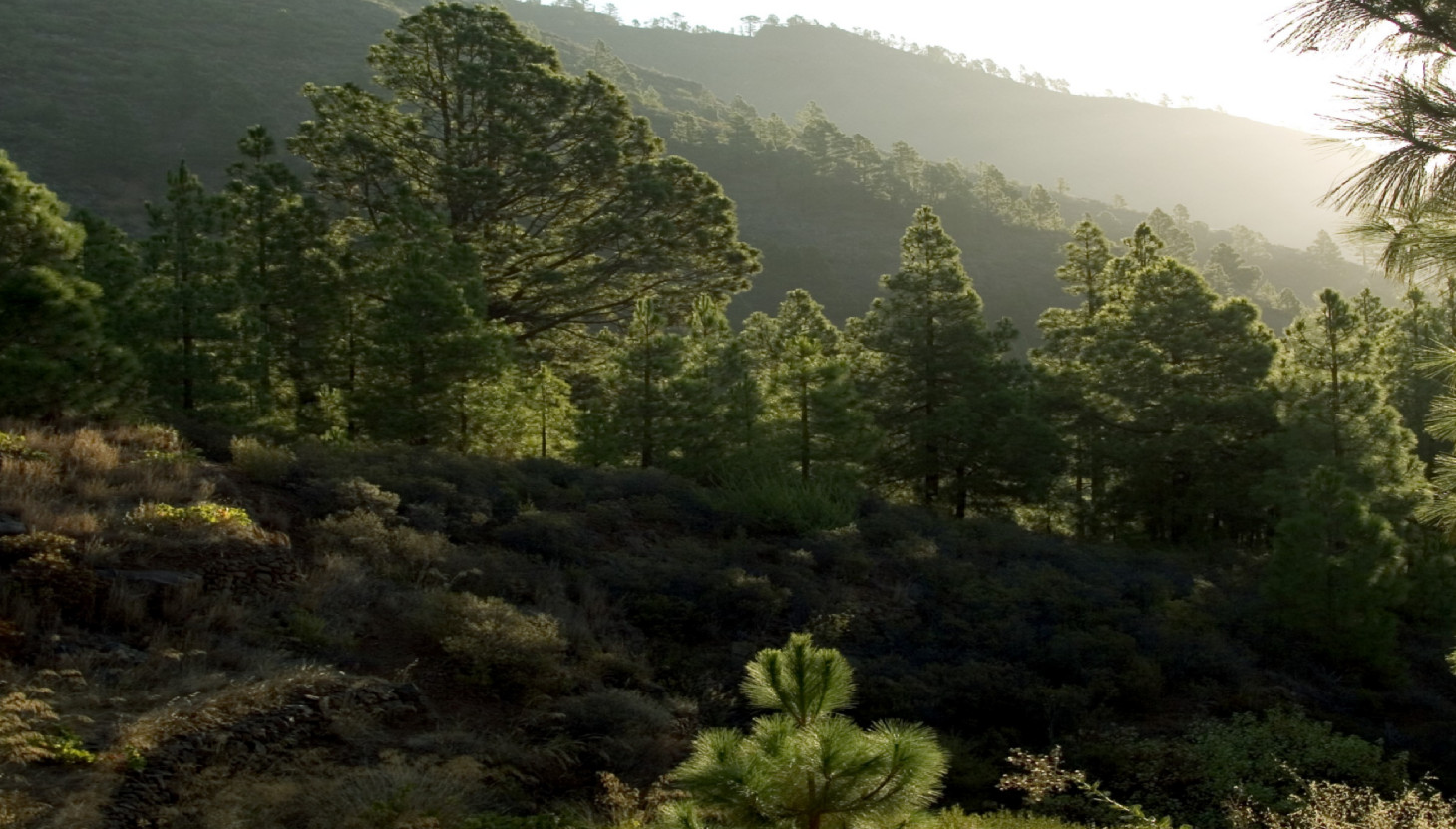
Candelaria has an outstanding number of flora and fauna specimens which are protected for their ecological values. For this reason, Candelaria’s Environment Department has prepared the «Itineraries to observe nature in Candelaria».
Six guides invite you to explore its natural environment to appreciate and recognize the most outstanding flora and fauna species. To do so, they have used Candelaria’s Local Footpaths Network, along which these self-guided itineraries can be followed.
For further information:
Concejalía de Medio Ambiente (Environment Department)
Tel: +34 922 500 800 ext. 7102-7103
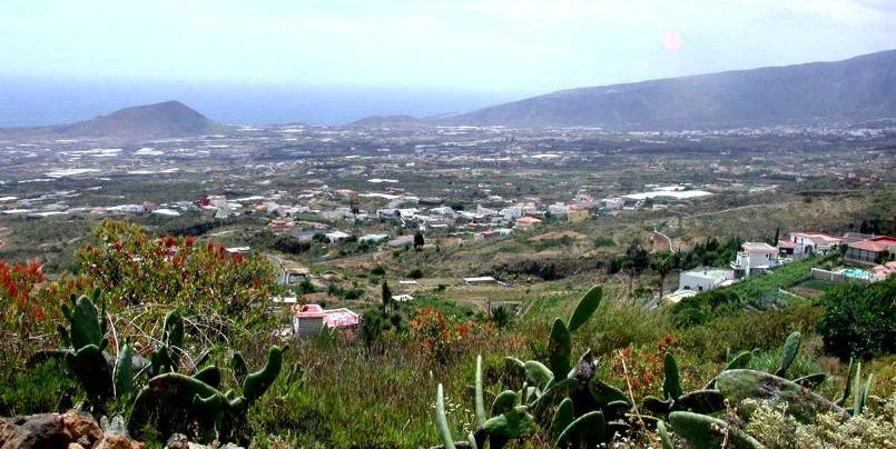
About 800,000 years ago, Arafo’s massive stratovolcano suddenly collapsed on its southern flank. It was formerly located in the current Dorsal de Pedro Gil. The landslide material was dragged down to the sea causing one huge massive that swept the west coast of Gran Canaria away.
This is how the Güímar Valley was created. Although it was partially filled in by later eruptions, today we can still observe enormous scars of a sinkhole on both the Güímar and the Chafa slopes. Sheltered by the latter, this route runs along Monte de Los Brezos.
 Festivities and traditions
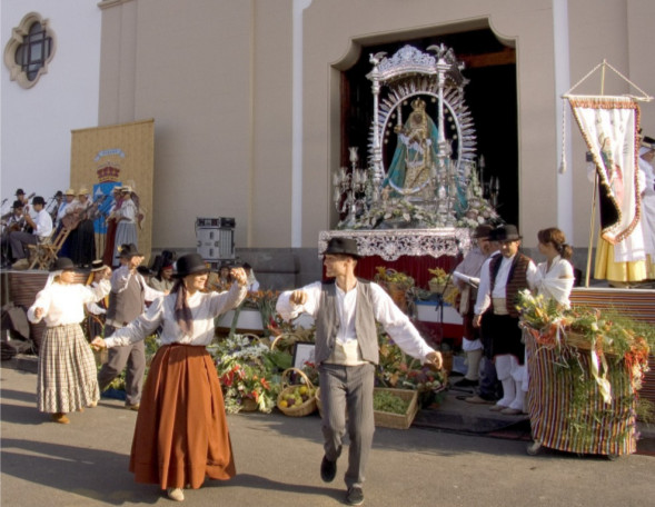
1st and 2nd February Virgin of Candelaria. It has been celebrated since 1497 when Alonso Fernández de Lugo, conqueror of Tenerife, celebrated the first «Fiesta de las Candelas» on the same date as the «Festivity of the Purification of the Virgin». On this day, candles play an important role: they symbolize Jesus as the light of all men. A procession takes place on the night between the 1st and the 2nd of February, which is popularly known as «Procesión de las Cadelas»; lights of the town center are extinguished while the parishioners march with candles and pray the Rosary.
14th and 15th August. Celebration of the most popular and main events in honour of the Patron Saint of the Canary Islands. This festivity coincides with others like the Mary Ascension Day, the ancient «beñesmén», a Guanche celebration, and the harvesting festivities. Pilgrims from all over the island cover long distances to reach Candelaria. All deeply-rooted Canarian traditions have an appointment on these days. The streets of Candelaria are dressed up with colour and joy. Canarian wrestling matches and traditional games are organized. Other events like the appearance of the Virgin to the Guanches, the fireworks display, the pilgrimage and the folkloric-floral offering also take place.
16th and 26thJuly. Festivities in honour of the Virgins Carmen and St Anne. Highlights include the boat and maritime procession of the patron saint of fishermen, the open-air dances, the dance of farmworkers and fishermen, the bolero festival, and the election of the queen. Carnival takes place in February and stands out for its joy and colour. The regional meeting of street musicians «Encuentro Regional de Murgas» brings together the winning groups of both provincial carnivals.
During Holy Week a unique event takes place: The Passion of Jesus is represented. The square Plaza de la Patrona de Canarias is a living stage where the last twelve hours of Jesus’ life are represented.
Otras fiestas:
Marzo:
March 19th: pilgrimage in honour of St Joseph, in Barranco Hondo.
May:
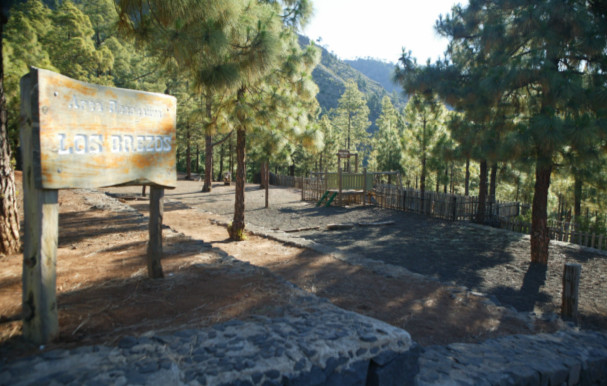
First Sunday: Festivity of St Rose, in Las Cuevecitas. Last Sunday: St Isidro Pilgrimage in Los Brezos Recreational Area, Araya.
June:
June 13th: Festivity of St Anthony, in Malpaís.
June 24th: Festivity of St John, in Playa de la Viuda, Igueste de Candelaria y Araya.
July:
Second Sunday: festivity of the Holy Trinity, in Igueste de Candelaria. Last August weekend: festivity of the Virgen del Mar, in Bajo la Cuesta de las Tablas. Last August weekend: Festivity of St Mary Magdalene, in Las Caletillas.
August:
Second Sunday: festivity of the Holy Trinity, in Igueste de Candelaria. Last August weekend: festivity of the Virgen del Mar, in Bajo la Cuesta de las Tablas. Last August weekend: Festivity of St Mary Magdalene, in Las Caletillas.
Octubre:
October 13th: Anniversary of the Canonical Coronation of the virgin’s Holy Image.
October 22nd: festivity of St. Rita, in Araya. Second Sunday: Festivity of Our Lady of Dolores in Barranco Hondo.
November:
November 30th: Festivity of St Andrew, in Las Cuevecitas.
December:
December 8st: festivity of the Inmaculada Concepción (the Blessed Virgin);
December 31st: Sylvester’s Day in Candelaria.